CDN NEWS |
  US NEWS


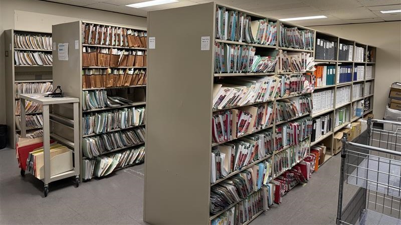
For energy land professionals, land information is an incredibly valuable asset. Yet, ironically, this critical data often becomes a bottleneck, hidden in overflowing file rooms or scattered across multiple applications. The time spent trying to locate the information you need can significantly hinder your operations and decision-making processes.
The Challenge: Time Lost in the Search
Consider the immense volume of data you manage: thousands of files, each potentially holding a crucial piece of information. Or you find the right documents but struggle to read the hand-written notes or spend more time looking for documents that will add more context. The time it takes to find information directly impacts your productivity and ability to meet deadlines. This isn’t just an inconvenience; it’s a critical drain on efficiency when you have limited time and important decisions to make.
The Solution: Transforming Data into a Searchable Asset
The answer is not merely to scan your documents and drop them into a digital folder, as this doesn’t truly solve the search problem. Instead, the key is to migrate your land records into an organized, searchable library. This transformation is essential for turning your valuable information into an easily accessible resource.
To achieve this, specialized services can help by properly organizing your land information, making it significantly easier to find what you need. This involves a comprehensive process that leverages expertise and even AI-assisted tools:
- Scanning every piece of paper: Bringing all your physical records into a digital format.
- Properly separating and orienting documents: Ensuring each document is correctly identified and positioned.
- Eliminating duplicates: Removing redundant files to streamline your data.
- Classifying documents: Categorizing information for logical organization.
- Recording extracted data into searchable fields: This is a crucial step, populating your land system with data points that allow for quick, targeted searches.
- Creating digital polygons on interactive maps: Through GIS mapping services, you can visualize your land assets on a map, adding a powerful spatial dimension to your search capabilities.
The Benefit: Faster Answers, Met Deadlines
By implementing such a structured approach, the most significant benefit is clear: you will spend less time searching for answers. This directly translates to meeting your deadlines more consistently. The shift from chaotic paper files to an organized, searchable system, is about unlocking the true value of your land information by making it instantly accessible. Data at your fingertips, allows you to make critical decisions with speed and confidence.
It’s Time to Migrate from Paper to Polygons
Share This: