CDN NEWS |
  US NEWS


Location services have been a hot topic in both the technological and social spheres for a while now. While many industrial companies pursue digital transformation strategies, the majority of those rely on location intelligence. In particular, there is an increased demand for tools that cater to a wide range of businesses with the power of geographic information systems, or GIS.
GIS used to be a costly tool only used by a limited number of engineers, but that is changing. Now, industries of all kinds are finding new ways to improve how GIS information & tools based on such can enhance collaboration and serve their clients while being accessible and user-friendly.
New user-friendly tools to meet unique business needs
Oil & gas industry, as well as environmental consulting too have been a part of the GIS adoption path. Within such fields, there has been a growing trend on the market for location-based software development. Specifically, location visualization that can bring visibility and simplicity to a complex set of tasks, depending on a geospatial data component.
Understanding the importance of a map view feature within various fields, many engineering, construction, field services and environmental leaders realize that a more accessible GIS software solution is needed for minimizing operations risks while maximizing ROI. The question at this point is — in which form, at what speed, and at what integration cost of GIS software should be implemented to improve their business processes.
Traditional project management is getting a facelift
Environmental agencies, for instance, have always had to deal with large arrays of data from a myriad of sources. Teams work on various tasks for each project, bringing information from the field, labs, government offices, and other sources. Most teams, however, would require different tools and subscriptions to collect and analyze data. That is why an obvious solution came to light — a one-stop-shop platform that would benefit team collaboration and decrease spending on subscriptions to different applications and user seats.
Another identified need within field services is real-time updates and collaboration. At times, data can be sensitive and greatly depend on the time of delivery. In cases of delay, the company will have to carry all costs and push deadlines and completion estimations. Additionally, hundreds of permits, forms, spreadsheets and maps are constantly being used by all team members.
A paper-based approach in project management is never an ideal strategy, and for those businesses that dare to shift operations, new efficiencies and better collaboration are changing the game.
Connecting more team members with the data they need in real-time
The collaboration part of the technology enhances business exploration and development activities and increases ROI while saving costs and boosting efficiency. The most cost-effective way to achieve this is with a turn-key GIS solution for non-technical professionals. Matidor, a platform developed by GIS and project management professionals for all types of teams, is sector agnostic and highly integrated — bringing much-needed simplicity and visibility to a complex business world.
It is essential to have improved communication among stakeholders for better and faster decision-making and smart budget allocation. Many more tools are available at the hands of project managers.
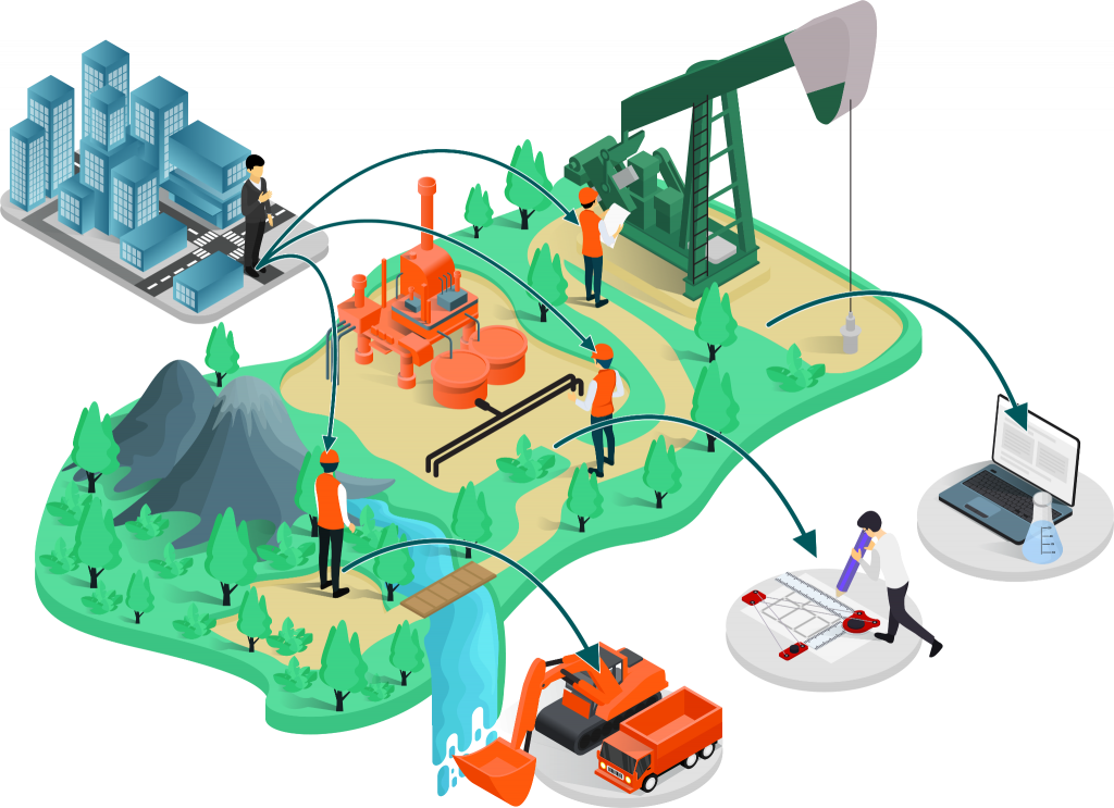
Pic 1. A variety of data formats incoming from stakeholders and team members can be much more user friendly and not require multiple platforms for project managers to keep track of.
The Matidor platform was designed to handle location visualization and project collaboration at once. Non-technical users can utilize it without being dependent on GIS professionals, and all team members can access it without the usual expense of traditional GIS solutions.
Maps make data easier to visualize and understand
Matidor’s interactive map interface uniquely meets the needs of field professionals: geospatial and project information relating to physical locations can be readily seen and understood by technical and business audiences thanks to its intuitiveness and connectivity with third-party applications.
This one-stop solution gives companies total visibility over their entire operation portfolio on a map, which can be zoomed in at any time for a specific project’s site layout, tasks, budgets, expenses, files, and historical activities. Rapid access to information improves efficiency, enables better decisions and reduces safety and financial risks.
In addition, Matidor’s unlimited sharing eliminates the collaboration hurdles between companies and unlocks new business development opportunities.
Matidor is not just another regular standalone GIS application. It is a multi-functional project management and visualization tool that can serve many industries, and what’s most important – make sure the project information is visual, detailed, and available for professionals and collaborators at all times.
See for yourself how GIS-powered project management can improve your business operations. Join us on a free consultation call.
Share This: